| Home | Services | Store | Downloads | Articles | Help | ||
|
Recommended Books & Products In association with our trusted partners Amazon and High Point Scientific |
||
|
Skymaps.com/store -- Recommended Books & Products for Skywatchers |
|
New Books •
Star Atlases •
Planispheres •
Getting Started •
Observing Guides •
Telescope Books •
Kids Books •
Sky Myths
Almanacs • History & Artistry • Star Map Prints • AstroPhotography • Telescopes & Binoculars • Media • Astro Calendars |
| As an Amazon & HPS affiliate we earn a small commission (at no extra cost to you) from qualifying purchases |
|
Help Support The Evening Sky Map The Evening Sky Map is designed to help all sky watchers to discover the wonders of the night sky. Monthly editions for Northern, Southern and Equatorial latitudes make The Evening Sky Map a unique resource for users worldwide. Please consider supporting this free service by making a donation or by purchasing recommended products. Thank you. |
| Category >> | Star & Moon Atlases | |
| Choosing a star atlas can be a difficult task. We provide a quick-look comparison chart of key features so you can select the star atlas that's best for you. | ||
|
Comparison of Current Printed Star Atlases & Maps Level:  Beginner Beginner  Intermediate Intermediate  Advanced Advanced
|
||||||
| Star Atlas | Mag. | Stars | Objects | Charts |
Scale (mm/deg) |
RRP |
|
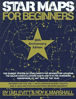
Star Maps for Beginners 50th Ed., 1992 by Levitt and Marshall |
4.5 | <900 | <10 |
12 charts 11" x 8.5" |
1.0 | $14 |
|
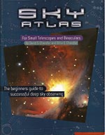
Sky Atlas for Small Telescopes 3rd Ed., 2007 by Chandler & Chandler |
6.0 | 4,800 | <200 |
8 charts 10" x 8" sample |
1.7 | $14 |
|
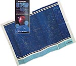
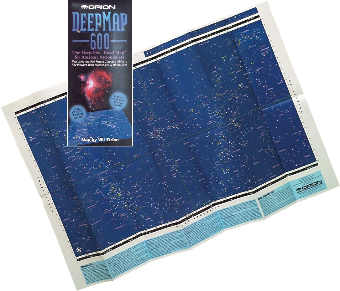
Orion DeepMap 600 2nd Ed., 2002 by Wil Tirion |
5.5 | 2,500 | 600 |
1 sheet 31" x 21" sample |
2.1 | $22 |
|
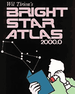
Bright Star Atlas 2000.0 2nd Ed., 2001 by Wil Tirion & Brian Skiff |
6.5 | 8,833 | 600+ |
10 charts 11.1" x 7.8" sample |
2.4 | $10 |
|
Norton's Star Atlas 20th Ed., 2003 by Ian Ridpath (Editor) |
6.5 | 8,800+ | 600+ |
9 charts 15" x 10" |
3.2 | $30 |
|
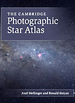
The Cambridge Star Atlas 4th Ed., 2011 by Wil Tirion |
6.5 | 8,800+ | 921 |
20 charts 10.4" x 7.8" |
3.2 | $33 |
|
The Observer's Sky Atlas 4th Ed., 2023 by Erich Karkoschka |
6.0 | 4,800 | 500 |
61 charts 7.5" x 9.5" |
2.5 & 10 (inserts) |
$40 |
|
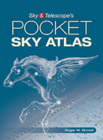
Pocket Sky Atlas 1st Ed., 2006 2nd Ed., 2020 by Roger W. Sinnott |
7.6 | 30,000+ | 1,500 |
80 charts 9" x 6" sample |
5.0 | $20 |
|
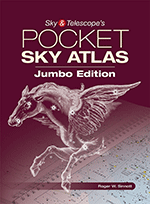
Jumbo Pocket Sky Atlas 1st Ed., 2016 2nd Ed., 2020 by Roger W. Sinnott |
7.6 | 30,000+ | 1,500 |
80 charts 11.7" x 8.3" |
6.5 | $40 |
|
Sky Atlas 2000.0 Deluxe 2nd Ed., 1998 & 2007 by Wil Tirion & Roger W. Sinnott |
8.5 | 81,312 | 2,700 |
26 charts 21" x 16" sample |
8.2 | $60 |
|
interstellarum Deep Sky Atlas 1st Ed., 2015 by Ronald Stoyan & Stephan Schurig |
9.5 | 201,719 | 14,835 |
114 charts 10.2" x 11.0" |
15.0 | $110 |
|
Uranometria 2000.0: Deep Sky Atlas (All Sky Edition) Dec. 2012 by Tirion, Rappaport & Remaklus |
9.75 | 280,035 | 30,000+ |
220 charts 18" x 12" sample |
18.5 | $60 |
|
Last Updated: 5 August 2020 |
|
Out of Print Star Atlases & Maps Level: Beginner Intermediate Advanced
|
||||||
| Star Atlas | Mag. | Stars | Objects | Charts |
Scale (mm/deg) |
RRP |
|
Uranometria 2000.0 (2 Vols.) 2nd Ed., 2001 by Tirion, Rappaport & Remaklus |
9.75 | 280,035 | 30,000+ |
259 charts 18" x 12" sample |
18.5 | $50 ea. |
|
The Millennium Star Atlas Softcover Ed., Feb 2006 by Roger W. Sinnott & Michael A.C. Perryman |
11.0 | 1,058,332 | 10,725 |
1,548 charts 13" x 9.25" sample |
36.0 | $150 |
|
Star Maps for Beginners by I.M. Levitt and Roy K. Marshall 64 pages, 50th Anniversary Edition, September 1992 Level: Beginner
List Price: The book also includes a chapter on the history of the constellations, and the ancient legends and mythological lore surrounding them. There is even a section on meteors and when and where to spot them. First published in 1942, Star Maps for Beginners has sold over 500,000 copies. Note: These maps are very basic and contain much less detail than The Evening Sky Map.
Amazon.com Customer Comment: |
|||||||||||||
|
Sky Atlas for Small Telescopes and Binoculars by David S. Chandler & Billie E. Chandler 24 pages, 3rd Edition, August 2007 Level: Beginner
List Price: Book Description: Anyone who uses a telescope needs a sky atlas as a guide to finding star clusters, nebulae, galaxies, double stars, etc... The problem is most sky atlases assume the user has at least a 6-inch diameter telescope, whereas the vast majority of beginners start with small 2.5 inch to 4-inch telescopes. Beginners may meet with frustration attempting to view objects too faint for their equipment. Sky Atlas for Small Telescopes and Binoculars fills the literature vacuum for users of telescopes in this size range. With two polar charts and six vertical gores (reminiscent of the classic Norton's Star Atlas) Sky Atlas for Small Telescopes and Binoculars covers the whole sky down to 6th magnitude stars and maps nearly 200 deep sky objects, with accompanying descriptions and small detail maps on the facing page. Every object shown here is visible (in dark skies) with either a 2.5-inch diameter telescope or a common pair of binoculars. This atlas will help the beginner with minimal equipment. In addition introductory material discusses observing the sky, selecting of equipment, presents an overview of what is visible in the Milky Way and beyond, gives instructions for using the atlas, and makes recommendations for the next steps in observing. A resource list of books, software, and periodicals for the observer is included. Amazon.com Customer Comment: |
|||||||||||||
 View Detail (1) View Detail (2) |
Orion DeepMap 600 (Folding Star Chart) by Wil Tirion (Illustrator) 1 chart, November 2003 Level: Beginner to Intermediate
List Price:
Features:
Note: The South circumpolar region south of -60° is not included in DeepMap 600. This is of no consequence for observers located north of 30° north latitude.
Amazon.com Customer Comment: |
|||||||||||||
|
Bright Star Atlas 2000.0 by Wil Tirion & Brian Skiff 32 pages, January 2001 Level: Beginner to Intermediate
List Price: Book Description: Some years ago we purchased a pair of used binoculars and tucked them away in the car. It's amazing how many times they have come in handy during the daylight hours and it is one of life's little satisfactions to pause beside the road on a starry night and look at the stars. All that was lacking was a nice inexpensive atlas to accompany the binoculars. The Bright Star Atlas is intended just for this purpose. This 10 map atlas of the night sky is drawn by Wil Tirion and us based upon the Hipparcos and Tycho Catalogs with a stellar limiting magnitude of 6.5. Opposite each full page map Brian Skiff of the Lowell Observatory has prepared a tabular listing of interesting objects visible in binoculars or small telescopes. These include galaxies, open clusters, diffuse nebulae, bright nebulae, planetary nebulae, double stars, and variable stars. Atlas includes a set of seasonal star maps to help orient the user to the night sky throughout practically the entire populated world. Objects in Skiff's catalog are also listed in cross referenced tables. Ideal companion atlas to the larger Sky Atlas 2000.0 or Uranometria 2000.0. Amazon.com Customer Comment: |
|||||||||||||
|
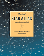
Norton's Star Atlas & Reference Handbook by Ian Ridpath (Editor) 200 pages, 20th Edition, October 2003 Level: All
List Price: Generations of amateur astronomers have called it simply Norton's: the most famous star atlas in the world. Now in a superbly redesigned, two-color landmark 20th edition, the first of a new century, this combination star atlas and reference work has no match in the field. First published in 1910, coinciding with the first of two appearances by Halley's Comet during the book's life, Norton's owes much of its legendary success to its unique maps, arranged in slices known as gores, each covering approximately one-fifth of the sky. Every star visible to the unaided eye under the clearest skies -- down to magnitude 6.5 -- is charted along with star clusters, nebulae and galaxies. Extensive tables of data on interesting objects for observation accompany each of the precision drawn maps. Preceding the maps is the unique and authoritative reference handbook covering timekeeping and positional measurements on the celestial sphere; the Sun, Moon and other bodies of the Solar System; telescopes and other equipment for observing and imaging the sky; and stars, nebulae and galaxies. Throughout, succinct fundamental principles and practical tips guide the reader into the night sky. The appendices Units and Notation, Astronomical Constants, Symbols and Abbreviations, and Useful Addresses complete what has long been the only essential reference for the stargazer. Now presented more accessibly than ever before, the text and tables of the 20th edition have been revised and updated to take account of the new and exciting developments in our observation of the cosmos. The redesignedstar maps offer outstanding legibility, in the living room or under a red light in the dark outdoors. Presented with an authority that has stood for generations, Norton's Star Atlas and Reference Handbook remains the indispensable companion for all who gaze at the night sky. For use with your first pair of binoculars, in choosing your first telescope, and as a trustworthy companion no matter how far your interest takes you, this elegant edition launches Norton's into a new century as the classic reference in astronomy. Amazon.com Customer Comment: |
|||||||||||||
|
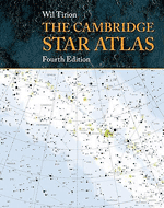
The Cambridge Star Atlas by Wil Tirion 96 pages, 4th Edition, March 2011 Level: Beginner to Intermediate List Price: Amazon Price: Click Here & Save Average customer rating: More info: click here Also available at: Amazon.co.uk (UK) Description: This classic star atlas is ideal for both beginning astronomers and more experienced observers worldwide. The clear, full-color maps show stars, clusters and galaxies visible with binoculars or a small telescope. The atlas also features constellation boundaries and the Milky Way, and lists objects that are interesting to observe. This new edition features a clearer map of the Moon's surface, showing craters and features; a second Moon map, mirror reversed for users of telescopes with star diagonals; enhanced index charts showing the constellations more clearly; and a new data table listing stars hosting planetary systems. It is now spiral bound, making it ideal for use at the telescope.
Amazon.com Customer Comment: |
|||||||||||||
|
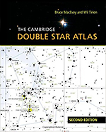
The Cambridge Double Star Atlas (2nd Edition) by Bruce MacEvoy (author), James Mullaney (author) and Wil Tirion (illustrator) 170 pages, 2nd Edition, December 2015 Level: All
List Price:
|
|||||||||||||
|
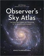
Observer's Sky Atlas The 500 Best Deep-Sky Objects With Charts and Images by Erich Karkoschka 144 pages, 4th Edition (Updated and in Full Color), March 2023 Level: All
List Price: This tremendous new edition of a classic book (previously published only in black-and-white) contains star charts and pictures, for all those who observe the night sky with unaided eyes, binoculars or telescopes. It is equally useful for beginners and experienced old hands at astronomy. A legend among hobby astronomers, this entirely revised and updated edition has new celestial maps in full color, up-to-date data from the Gaia spacecraft and unique comparison images of most visible celestial objects. Sixty-one all-new star charts are good through 2060, and there are 532 pictures of stars, galaxies and nebulae, 415 of them in full color. Very detailed position figures help the astronomer navigate the charts and accurately pinpoint objects for viewing -- and knowing what you're seeing. The hobby astronomer can use it to find star clusters, gaseous nebulae and galaxies throughout the night sky. Quick orientation is guaranteed, and intermediate astronomers can really enjoy the night sky for hours and hours by knowing where to locate the objects of their interest.
Amazon.com Customer Comment (3rd Edition): |
|||||||||||||
|
Pocket Sky Atlas by Roger W. Sinnott 136 pages, 2nd Edition, August 2020 Level: Intermediate Size: 9.2 x 6.8 inches
List Price: Sky & Telescope's celestial atlases are the standard by which all other star atlases have been judged for more than half a century. Our Pocket Sky Atlas is no exception. This wonderfully detailed atlas is particularly handy to take on trips and use at the telescope, thanks to its compact size, convenient wire-bound design, and easy-to-read labels. To help you find your way, the charts show both constellation boundaries and stick figures. By popular request, two special new lists are included in this second edition. One is a table of the atlas's 53 stars of unusual reddish hue (also known as carbon stars), and the charts where they are found. The other is a list of 24 nearby stars, with their distances in light-years and the charts showing their locations. All can easily be spotted in small telescopes. Features:
Amazon.com Customer Comment: |
|||||||||||||
|
Pocket Sky Atlas: Jumbo Edition -- New Edition due in August 2020 by Roger W. Sinnott 136 pages, 2nd Edition, August 2020 Level: Intermediate Size: 11.9 x 9 inches
List Price: Sky & Telescope's celestial atlases are the standard by which all other star atlases have been judged for more than half a century. Our Pocket Sky Atlas -- Jumbo Edition is one of our favorites. This wonderfully detailed atlas is particularly handy to take on trips and use at the telescope, thanks to its larger size, convenient wire-bound design, and easy-to-read labels. To help you find your way, the charts show both constellation boundaries and stick figures. By popular request, two special new lists are included in this second edition. One is a table of the atlas's 53 stars of unusual reddish hue (also known as carbon stars), and the charts where they are found. The other is a list of 24 nearby stars, with their distances in light-years and the charts showing their locations. All can easily be spotted in small telescopes. Features:
|
|||||||||||||
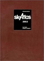 |
Sky Atlas 2000.0, 2nd Edition by Wil Tirion and Roger W. Sinnott 2nd Edition, 1998 (Cambridge University Press). Reprinted 2007 (Sky Publishing). Level: Intermediate to Advanced Highly Recommended The best-selling star atlas for intermediate and advanced amateur astronomers. Available in 3 different versions -- Deluxe, Field, and Desk (refer to the handy table below for details). Can also be purchased laminated in clear plastic for protection from wear and the outdoors. Each version of Sky Atlas 2000.0 contains 26 charts covering the entire sky. It shows 81,312 single, multiple, and variable stars of magnitude 8.5 and brighter as well as 2,700 deepsky objects. The Milky Way is portrayed with four shades of blue that represent approximate brightness levels (Deluxe version only). In addition, separate charts provide close-ups of both celestial poles, Proxima Centauri, Barnard's Star, and the Virgo-Coma galaxy region. All editions of Sky Atlas 2000.0 include an acetate coordinate grid overlay for accurate determination of position.
Laminated Editions: The charts are completely sealed with a clear plastic film for maximum protection against weather, spills, and everyday wear and tear. You can even jot notes on them with an erasable pen and wipe them clean later.
Average customer review at Amazon.com:
Note: Sky Atlas 2000.0 is becoming increasingly difficult to find and is often Out of Stock at Amazon.com and elsewhere. Links to on-line retailers with known stock are included below.
Deluxe Edition: Chart size 21 x 16-3/4 inches.
(White stars and white deep-sky objects on black background) This edition is preferred by some astronomers for outdoor use in the dark.
(Black stars and black deep-sky objects on white background) This edition is preferred by some astronomers for indoor use at a desk.
|
|||||||||||||
|
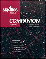
Sky Atlas 2000.0: Companion by Robert A. Strong and Roger W. Sinnott 304 pages, 2nd Edition, May 2001 Level: Intermediate to Advanced
List Price:
Amazon.com Customer Comment: |
|||||||||||||
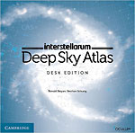 |
interstellarum Deep Sky Atlas by Ronald Stoyan and Stephan Schurig 264 pages, 1st Edition, December 2014 (UK) / February 2015 (US) Level: Intermediate to Advanced
Desk Edition: |
|||||||||||||
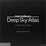 |
Field Edition: This edition comes in a sturdy slipcase. The maps are printed on Polyart, which feels like paper, but is a sophisticated polyethylene foil. The cover is Priplak, a durable PVC material. The legend comes separately and can be put in a jacket on the inner sleeve. The entire set is waterproof and tear-resistant. You can write on it with water-soluble ink, and wipe it away. If getting wet, the atlas can be simply dried by wiping over the pages with a dry cloth. The pages will not get worn even if after being soaked into an aquarium! List Price: Amazon Price: Click Here & Save Average customer rating: More info (Field Edition): click here Also available at: Amazon.co.uk (UK) Description: The interstellarum Deep Sky Atlas heralds a new era of celestial cartography. It is an innovative, practical tool to choose and find stars, star clusters, nebulae and galaxies. Usually, deep sky objects are shown with just a standard symbol in the star charts. This atlas is different: all objects are shown according to their actual visibility. Four main visibility classes separate out objects that can be seen through 4-, 8- and 12-inch telescopes. Within each visibility class, the objects are labeled in different type weights and using graduated shades and colors for the symbols -- the bolder the label or the darker the symbol, the easier it is to see the object. Spiral-bound and printed in red-light friendly colors on dew-resistant paper, this full-sky atlas has a limiting magnitude of 9.5, plotting over 200,000 stars. It is the ideal companion for amateur observers of all levels. Stars:
|
|||||||||||||
|
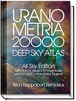
Uranometria 2000.0: Deep Sky Atlas All Sky Edition by Wil Tirion (Illustrator), Barry Rappaport (Author), and Will Remaklus (Author) 220 double page charts, December 2012 Level: Advanced
List Price:
In 29 areas of heavy congestion, close-up charts are provided at 2 or 3 times normal scale with a stellar limiting magnitude approximating 11. Objects are indexed by Common Names, Star Names, Bayer Stars, Messier Objects, and NGC/IC Objects in the All Sky Edition and all 30,000+ non-stellar objects are indexed in the companion Deep Sky Field Guide. Know the name but not the position? No problem, these indexes make it a snap to find.
Amazon.com Customer Comment: |
|||||||||||||
|
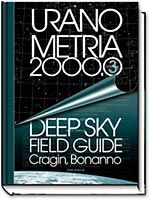
Uranometria 2000.0: Deep Sky Field Guide [Companion] by Murray Cragin and Emil Bonanno 2nd Edition, September 2001 Level: Advanced List Price: Amazon Price: Click Here & Save Average customer rating: More info: click here Also available at: Amazon.co.uk (UK) Description: The Deep Sky Field Guide provides basic catalog data, in easy to use, numerically ordered chart-by-chart tables for the 30,000+ non-stellar objects plotted on the 220 Uranometria 2000.0 charts. Most useful to telescope users of any aperture, CCD imagers and astrophotographers, this data includes precise coordinates, magnitude, and size for each object, as well as data specific to the various types of objects, such as: surface brightness, luminosity class and position angles for galaxies; number of stars and magnitude of brightest star for open clusters; alternate names and magnitude of central stars for planetary nebulae; opacity and descriptions for dark nebulae; concentration class for globular clusters; type and color for bright nebulae, etc... Notes are provided for 23,358 objects and include a description of each object and the direction to and magnitude of nearby stars, using either the GSC or Tycho catalogs. Such information can pinpoint the object's location, especially useful for very faint objects. Amazon.com Customer Comment: |
|||||||||||||
| Out of Print Star Atlases: | ||||||||||||||
  |
Uranometria 2000.0: Deep Sky Atlas (Out of Print) by Wil Tirion and Barry Rappaport, and Will Remaklus 2nd Edition, September 2001 Level: Advanced Description: The most comprehensive stellar/deep-sky atlas and data resource. The three volumes of Uranometria 2000.0 are so much more than a "Second Edition," they can only be considered the fulfillment of that process to which the first edition was but prologue. Years in development, this massive achievement affords astronomers, astrophotographers and CCD imagers the finest roadmap to the heavens yet produced at such a modest price. More than 280,000 stars and over 30,000 deep sky non-stellar objects are located with a degree of accuracy heretofore unavailable in one resource. Encyclopedic in nature, with beautifully redrawn maps, a host of efficient navigation tools, and more accurate catalog data for three times the number of deep-sky objects shown in the preceding work, Uranometria 2000.0 is clearly an atlas and guide every telescope user, whatever their aperture, will want to own.
Average customer review at Amazon.com:
Publisher's Web site:
Volume 1: The Northern Hemisphere to -6°
Volume 2: The Southern Hemisphere to +6°
|
|||||||||||||

|
Millennium Star Atlas (Out of Print) by Roger W. Sinnott and Michael A.C. Perryman 1548 charts, February 2006 Level: Advanced Description: Hailed as the definitive reference set, the Millennium Star Atlas features 1,548 sky charts based on the European Space Agency's landmark Hipparcos and Tycho Catalogues. Detailed, comprehensive, and complete, this three-volume set shows more than one million stars, three times as many as any other atlas in print. More than 10,000 of the nearest stars are labeled with their distances in light-years, as determined by the Hipparcos satellite. The charts also include the locations, orientations, and aspect ratios of 8,000 galaxies. The generous angular scale and the faint limiting magnitude, corresponding to the survey limit of the Hipparcos satellite at around 11th magnitude, makes star-hopping to deep-sky objects a breeze.
The Atlas was originally released in 1997 and represents the astrometric results from the Hipparcos mission. At the time of publication it represented a ten- to one hundred-fold increase in accuracy compared to all previous sky surveys and it still is the most accurate star catalogue available. Product Info:
Average customer review at Amazon.com:
|
|||||||||||||
| Other Star Atlases: | ||||||||||||||
|
The Cambridge Photographic Star Atlas by Axel Mellinger and Ronald Stoyan 186 pages, 164 color illustrations, October 2011 Level: All
List Price: Features:
|
|||||||||||||

|
The Astrophotography Sky Atlas by Charles Bracken 144 pages, 1st Edition, November 2015 Level: All
List Price:
Amazon.com Customer Comment: |
|||||||||||||
| Moon Maps & Atlases: | ||||||||||||||
|
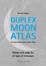
Duplex Moon Atlas The Next Generation Lunar Atlas by Ronald Stoyan 80 pages, 1st Edition, November 2022 Level: Intermediate to Advanced
List Price:
The Duplex Moon Atlas is designed to be used at the eyepiece. The colours are optimised for usage with a red torch at night. Atlas pages are printed to the margin and with the wire-o binding, pages can be spread out easily. Printed on laminated paper, dew wipes off easily, and the atlas will last a long time.
Amazon.com Customer Comment: |
|||||||||||||


|
Sky & Telescope's Field Map of the Moon by Antonin Rükl (Illustrator) 1 page, July & November 2005 Level: All Description: Here's the only Moon reference you'll ever need at the telescope! With new cartography from Antonin Rükl and more than 1,000 individually labeled landmarks, including the complete libration zones, your Moon-gazing will be more rewarding than ever. The unique design allows you to look at the entire Moon, individual quadrants, or any two neighboring quadrants at the same time, and the durable lamination will protect your map from dew, spills, and everyday wear and tear for years to come. Both versions are north up, but the mirror-reversed format is for telescopes (refractors and catadioptrics with star diagonals) with an odd number of reflections. Each laminated map is 12 inches by 12 inches, opens to 24 by 24 inches.
Average customer review at Amazon.com:
|
|||||||||||||

|
Atlas of the Moon by Antonin Rükl 224 pages, September 2004 Level: All Highly Recommended This book is considered to be the definitive Moon atlas by which all others are judged. It contains many highly detailed drawings of lunar features, most of which are visible in a 6-inch telescope under ideal conditions. The atlas also contains libration charts, the location of landing sites for US and Soviet lunar missions, notes on how to observe and photograph the Moon, and many excellent photographs. Back Cover: Atlas of the Moon is an authoritative source of information on the motion, rotation and illumination of the Moon, its surface, its origin and evolution, and its exploration in manned and unmanned space probes. Truly an atlas, a unique feature of this book is the detailed map in 76 sections of the near side of the Moon. There are photographs of areas of particular interest plus a map of the far side of the Moon. Atlas of the Moon is intended for beginners but the maps and the accompanying lists of the lunar formations would satisfy even the most experienced amateur lunar observer.
Average customer review at Amazon.com:
|
|||||||||||||


|
Skymaps.com/store -- Recommended Books & Products for Skywatchers |
|
New Books •
Star Atlases •
Planispheres •
Getting Started •
Observing Guides •
Telescope Books •
Kids Books •
Sky Myths
Almanacs • History & Artistry • Star Map Prints • AstroPhotography • Telescopes & Binoculars • Media • Astro Calendars |
 |
HOW TO ORDER: Step 1: Click item's Buy from Amazon link (opens a new window). Step 2: Click the "Add to Shopping Cart" button. Do this before browsing. Step 3: Repeat Steps 1 & 2 to add more items to same shopping cart. Step 4: Click the "Proceed to Checkout" button to complete the purchase. |
Copyright - Terms of Use - Privacy Policy - Contact Us Copyright © 2000-2025 Kym Thalassoudis. All Rights Reserved. |
|
Helpful Pages for Amazon.com Customers Payment Methods • Shipping & Delivery • Guarantee Protection • Returns Policy |